Discover how MapAll 360 can revolutionise your fibre network build
Whether you’re an operator or contractor, we’ve developed a suite of tools to maximise every stage of your network build, as well as empowering you to report defects and resolve obstructions.


01
Track build progress
Get full visibility of planned works, through to As-builts. Plan and build with accurate data, every time.
02
Live updates. Instant control.
Access real-time build information, commission/assign new projects, access reports and more. Giving you complete control.
03
Report blockages. Monitor repairs
Get homes connected quickly and be ready for service faster. Helping to drive revenue at pace.

04
Manage your team
Check-in on your crew’s location and see photo evidence of safety standards. Helping ensure you stay compliant.
05
Eliminate paper processes
Enjoy quick, easy, digital tools – in the field or in the office. Reducing admin, errors and time delays.
MODULES
From Design to Blockages to Build, MapAll’s modular software is designed around you
Built around a proprietary Core system, MapAll is comprised of bespoke modules designed to integrate with your existing systems.

GIS-based, web-based design tool specifically for the design of fibre optic networks (FTTx)

Ready to be used Out-Of-The-Box, pre-built for FTTx

Easier, more efficient, more accurate than generic tools such as QGIS, Google Earth, AutoCAD

Integrates with other systems via standard GIS APIs

GIS-based survey tool specifically for field inspections of fibre optic network routes (FTTx)

Walk-out survey of existing infrastructure, Poles, Chambers, Ducts, Joint Use Poles. Both Non-intrusive and Intrusive surveys

Walk-in survey of Premises, both SDU and MDU

Record Missing Inventory, Hazards, Notes
2-way integration with any GIS design tool via standard GIS APIs
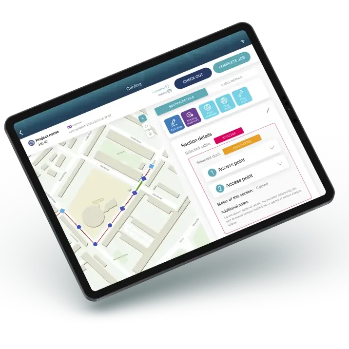
Complete, end-to-end, GIS-based solution for the management, reporting and documentation of the construction of fibre optic networks (FTTx)

Front-end app comes with a rich set of easy to use, field workflows dedicated to FTTx field operations

Captures As-built data in real-time, allowing rich As-built reports to be produced at any point in the construction project and not just at completion

As-built data is captured during and as a natural part of the execution of the field workflows, there is no additional overhead on the field crews

Integrates via standard GIS APIs with any GIS-based Design and PNI systems where the design is imported in to Mapall Build and the As-built is exported to the PNi.

Allows jointers to take photos at every stage of the splicing process. Cable, tube, fibre layouts and individual trays.
Enables the capture of GIS-based As-builts after the FTTx construction has been completed

Less time spent in the field as the front-end field app is more efficient and easier for field crews than manual capture

Detailed As-builts flow to the back office in GIS format from where they can be reported or exported (e.g. to PNI)
Integrates As-builts with other GIS systems (e.g. PNI) via standard GIS APIs
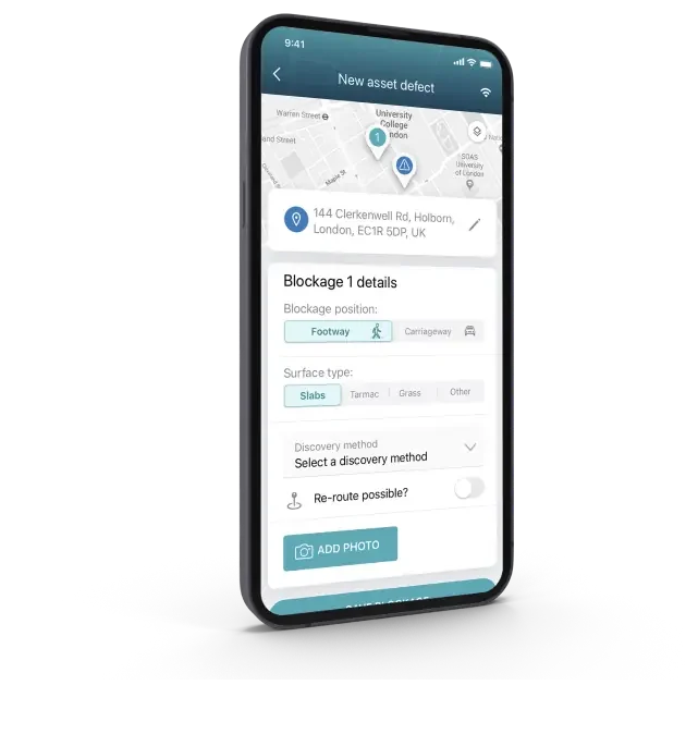
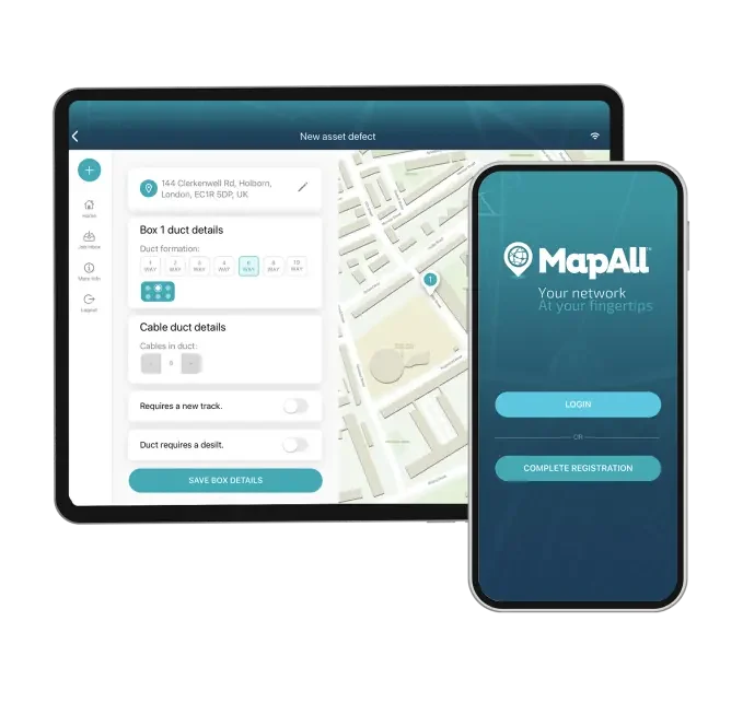
Mapall Blockages is for the capture, reporting and end-to-end management of PIA blockage A55 and A55b reports
Front-end field app walks the field crews through the capture of the Openreach required data in an intuitive and easy-to-use manner
Full back office management of the full lifecycle of the processes behind the A55 and A55b reports with a rich suite of management KPIs, dashboards and reports
98-100% acceptance of MapAll A55 Blockage Forms by Openreach.
Illuminating your network, giving you full visibility of every detail.
- Geo-smart GIS system, hosted in Cloud.
- Market-leading tech Best-of-breed SaaS solution.
- Effortless experience Cutting-edge digital experience.
- Secure Fully audited, secure, encrypted system.
- iOS and Android Easy app access on mobile or tablet.
- Multi-user Operator or contractor. Field crew or project manager.

As well as significant ROI, you can benefit from…
paper saving
operational cost savings
efficiency increase
time savings
The tool to empower all stakeholders. Optimising every stage of the process.

Increase productivity
Complete more work, more efficiently – helping to maximise build funds.
Dedicated support
Our platform is so easy to use, you’ll be up and running from Day One, and our expert team is here to support you at any time.

Full audit view
Record and access full complete schematics, including cable IDs, cable size, ducts, number of tubes and fibre counts.

Delight customers and investors
By getting more homes connected to fibre broadband as quickly as possible.

Enhance your workflows
With fully customisable workflows, MapAll does the hard work for you.

Full network analytics
Access multiple KPIs about every aspect of your network and projects.
